Montes - Sa Sinipida (B 441)
The pathway
Useful informations
Roadbook
The first section of the route, starting from Montes, develops entirely on a track (first 400m) under woodland (holm oak wood, up to Janna 'è Funtana Bona).
Having left the track, you take a nice path on the left, highlighted by a fence (we are in the locality of S'Iscala Betza, where a path branches off leading to the town of Orgosolo, about 13km away).
Continuing on our route, you instead reach the Janna 'è Funtana Bona pass...
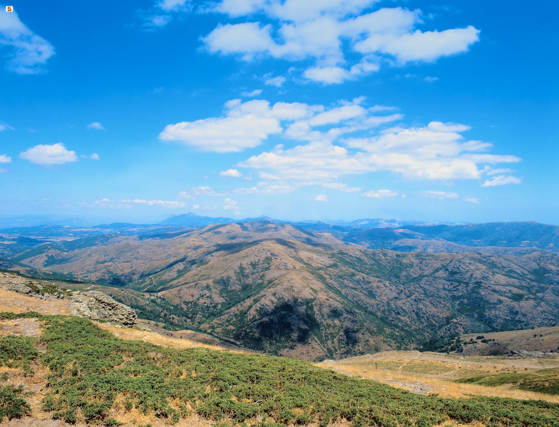
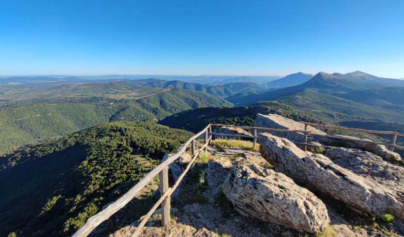
From Janna 'è Funtana Bona the panorama opens towards Fumai and the entire slope of Mandra 'e Caia. This point is in fact a crossroads of trails: some lead back to Montes, others delve into the sheepfolds of the area, while the main one, marked by the dry stone wall that climbs towards Mount Fumai, points towards the Flumineddu and indicates the border between Orgosolo and the territories of Villagrande and Talana (Isteone).
Our trail and the track climb, for an initial stretch, parallel and in a South-Southeast direction, until reaching the foot of Mount Fumai, where they separate to go around its base: the track passes on the western slope while the trail diverges, following the opposite slope up to Janna e S'Orroale where it branches into trail 441-D which allows completing the Fumai loop.
Superato Fumai, il sentiero punta decisamente a NordEst per raggiungere, su sentiero e poi su pista forestale, il waypoint di Janna 'e Monte Novo dopo circa 1,3 km: qui un altro bivio segnala l'incrocio con il 441 A che conduce a Badu Osti e dunque instrada verso la parte ogliastrina del Supramonte interno (territorio di Urzulei). Restando invece sul nostro percorso, dopo poco più di 100m si raggiunge l'imbocco per il sentierino (441B) che sale sul tacco di Monte Novo S.Giovanni, offrendo un panorama immenso sull'intero Supramonte che spazia da Gorropu al Corrasi e, più ad ovest, verso il Gennargentu.
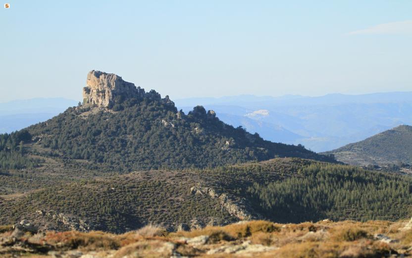
After passing Fumai, the trail heads decisively northeast to reach, on a path and then on a forest track, the waypoint of Janna 'e Monte Novo after about 1.3 km: here another fork indicates the intersection with 441 A which leads to Badu Osti and therefore directs towards the Ogliastra part of the inner Supramonte (territory of Urzulei). Instead, staying on our route, after just over 100m you reach the entrance to the small path (441B) that climbs the tacco of Monte Novo S.Giovanni, offering a vast panorama over the entire Supramonte that ranges from Gorropu to Corrasi and, further west, towards the Gennargentu.
Having reached M.Novo and skirted the limestone tacco (heel) at its base, continue on a slight descent towards the entrance of Sos Pisanos (Untana Sos Pisanos is the spring located nearby). We proceed on a gradual descent towards N-NE along a short section of trail that joins a forest track: we thus reach Sa Terrarva (an old sheepfold and a small house can offer makeshift shelter). A short section of track and then another section of trail allow us to reach Gutturu su Biu: an enormous channel that separates su Biu and Monte Nieddu.
We continue for the last 2.8 km along a path that runs along the base of Su Biu, reconnecting to a dirt road that leads back to Sa Senepida, crossing Badde Tureddu (where the famous secular holm oak on the rock is located). We descend in altitude from 1000 meters above sea level to 875 meters above sea level at the arrival point (Sa Senipida): about 400 meters before the end of the path, we will find the short detour that allows us to reach the sheepfold, which is also the point where the Si-CAi stages Z15 and Z16 meet.
Trail data and altimetry

Photogallery

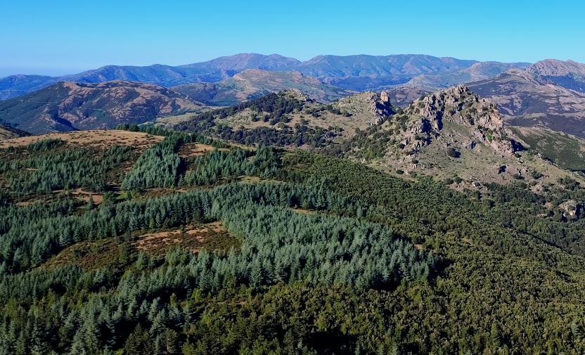
Forestas di Montes, nello sfondo M.Fumai e massiccio Gennargentu
Download trail documentation
Related pathways
Skip Pathways slider and jump to the next section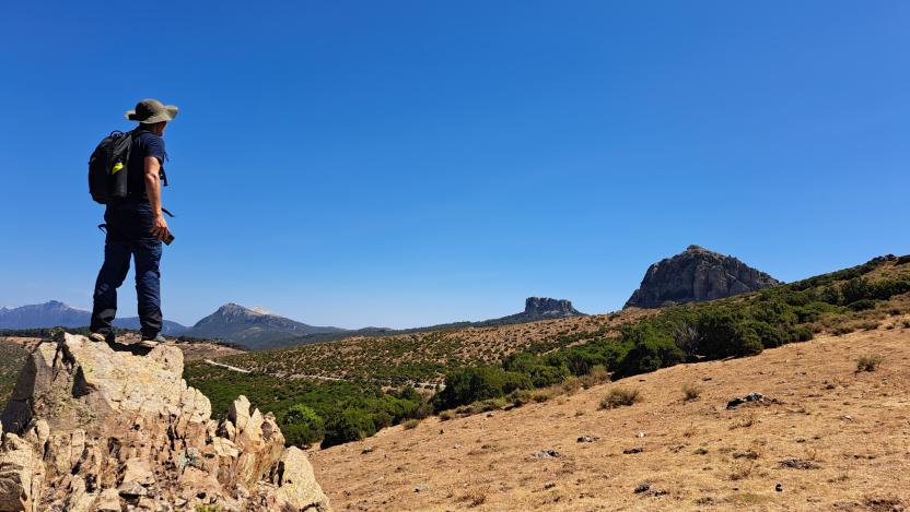
Pathways Correboi - Monte Fumai (B 460)

Pathways Janna Monte Novo - Badu Osti (B 441A)
Pathways Janna Monte Novo - M. Novo S. Giovanni (B 441B)
Pathways Sa Sinipida - Su Suercone (B 440)

Pathways Sos Pisanos - Untana Sos Pisanos (B 441C)
Related itineraries
Skip the Related itineraries slider and jump to the next section
Guides | Managing authority | Public Administration or institution
Skip Institutions slider and jump to the next section
Ente partner CAI sezione di Nuoro
Opinions
Reviews
siqujehpvq
Muchas gracias. ?Como puedo iniciar sesion?
