The point of interest
How to get here
GPS Coordinates: Lat. 39° 12' 46.54", Long. 8° 47' 20.74
A PIEDI (lungo il sentiero 203)
- From Cagliari, arriving by car at the WWF visitor center: Follow the SS 195 towards Pula, turn after 12 km onto the consortium road (towards Macchiareddu) and take the second road west to continue until the rural church of S. Lucia. From here, follow the WWF signs until you reach the "Sa Canna" visitor center. At this point, it is not possible to continue by car, as the historic forest track that allowed access from the WWF to the splendid "Perdu Melis" guesthouse has been seriously damaged by recent, catastrophic floods of the Rio Guttureddu, which have literally destroyed two vehicle bridges and, in several places, the road surface itself, essential for reaching the destination. Therefore, the only option is to walk, backpack on, the entire old road for about 7 km to Perdu Melis, from where the original route of trail 203 begins. Along trail 203, Burdoni is over 20 km from Sa Canna. From the former P. Melis guesthouse (304 m a.s.l.), continue until the 203/204 junction which indicates route 203, with final destinations Barracca Sassa-Burdoni.
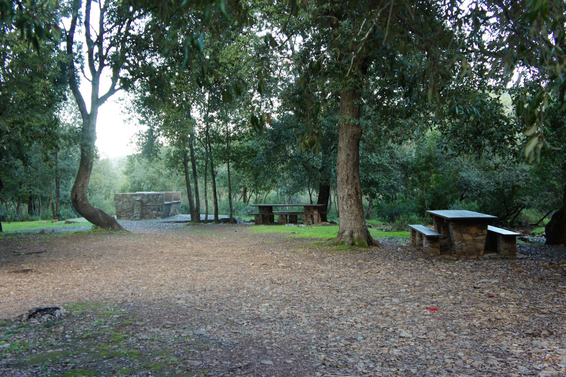
The route begins with a comfortable dirt road that runs alongside the "Perdu Melis" Canal. On the left, you leave the 220A trail that leads back to the 220 and 217 trails, going respectively to Lattias and Sa Canna (Aroni sheepfold). After about 50 minutes of walking, turn left and follow a path (through the vegetation) that offers panoramic views in some sections. It is possible to observe the valley dominated by the Lattias peaks, with a continuous display of small waterfalls on the right. Continue uphill until S'Arcu Gennixedda (739 m above sea level). Proceeding further, descend towards a path that leads to the WWF refuge of Barracca Sassa on the Riu Camboni (340 m above sea level). Leaving the refuge, ascend to Punta Tintillu (664 m above sea level) where you can observe unique granite rocks in various shapes. At this point, the itinerary continues downhill, running alongside the Riu de sa Perda: it is quite possible to spot some deer. The path then turns into an easy forest track that, after Punta Su Suergiu (529 m above sea level), leads to the "Burdoni" area, in the territory of Siliqua. Here, there is a well-equipped and comfortable picnic area.
- From Siliqua to Nuxis: a few minutes from the SS. 293 (Siliqua-Nuxis), at the start of trail 203, 13 km from Siliqua.
BY CAR
Traveling along State Road 293 from Siliqua to Nuxis, about 13 km from Siliqua on the left, you will find the start of trail 203. Nearby, but on the right side of the same state road, the entrance to the Campana Sissa forest area is also indicated.


