Warning! Route and signs in check and maintenance
The trail connects two sides of the perimeter of the Gutturu Mannu Natural Park: the part in the municipality of Uta and the part in the municipality of Siliqua.
A trail that needs a great physical effort and that, from the area of the Monte Arcosu Oasis, allow to cross the entire park in its length (from east to west) and to reconnect with the State Road 293 and therefore to the Campanasissa forestry complex.
The trail ends in the Burdoni area.
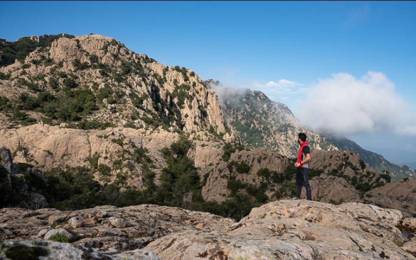
The trail goes through very different natural environments: from holm oak to the evolved scrub and the garrigue, passing through panoramic ridges, deep and wild valleys, in the undisputed kingdom of the Sardinian deer.
In the stretch along the Canale Perdu Melis (near the homonymous guest house) the trail runs few kilometers to the side of the river that offers, according to the seasons, a triumph of waterfalls and pools of medium and large, accompanying the hiker with the magical sound of water. .
The Track
Long-distance trail that is divided into two parts:
- trail - in pre-registration (D-203) from Case Perdu Melis to Burdoni; length: 16.8 km, uphill difference: 950 m, walking time: 7 hours;
- route (connection) to reach the D-203, from Sa Canna (WWF) to Case Perdu Melis (currently not registered, could take the number D-203A); length:7.2 km, uphill difference: 510 m, walking time: 3 hours.
Advices and key features
- It's a very long and challenging itinerary, recommended for trained people because the total walking time of the trail exceeds six hours, and has challenging slopes.
- It is essential to bring with you a good water reserve.
- Along the way, through the valleys, there will be no telephone signal so it's better not to venture alone, and be accompanied by experienced people.
- During particularly intense weather events, the conformation of the area makes these paths particularly dangerous from a hydrogeological point of view.
- The cistus, and more generally the growing vegetation, in some parts could make it difficult to identify the passage, so better to have and study carefully before the excursion detailed maps and/ or GPS track of the trail.
General description
From the WWF visitor center, the historic forest trail that from the WWF reached the beautiful guesthouse in the locality "Case Perdu Melis" has been seriously damaged by recent catastrophic floods of the Guttureddu River, that have literally destroyed two bridges and - at different points - the same road plan, essential to reach the destination by car.
For this reason the only alternative is to walk on foot the old road for about 6.7 km to Perdu Melis, from where the original route of path D 203 starts.
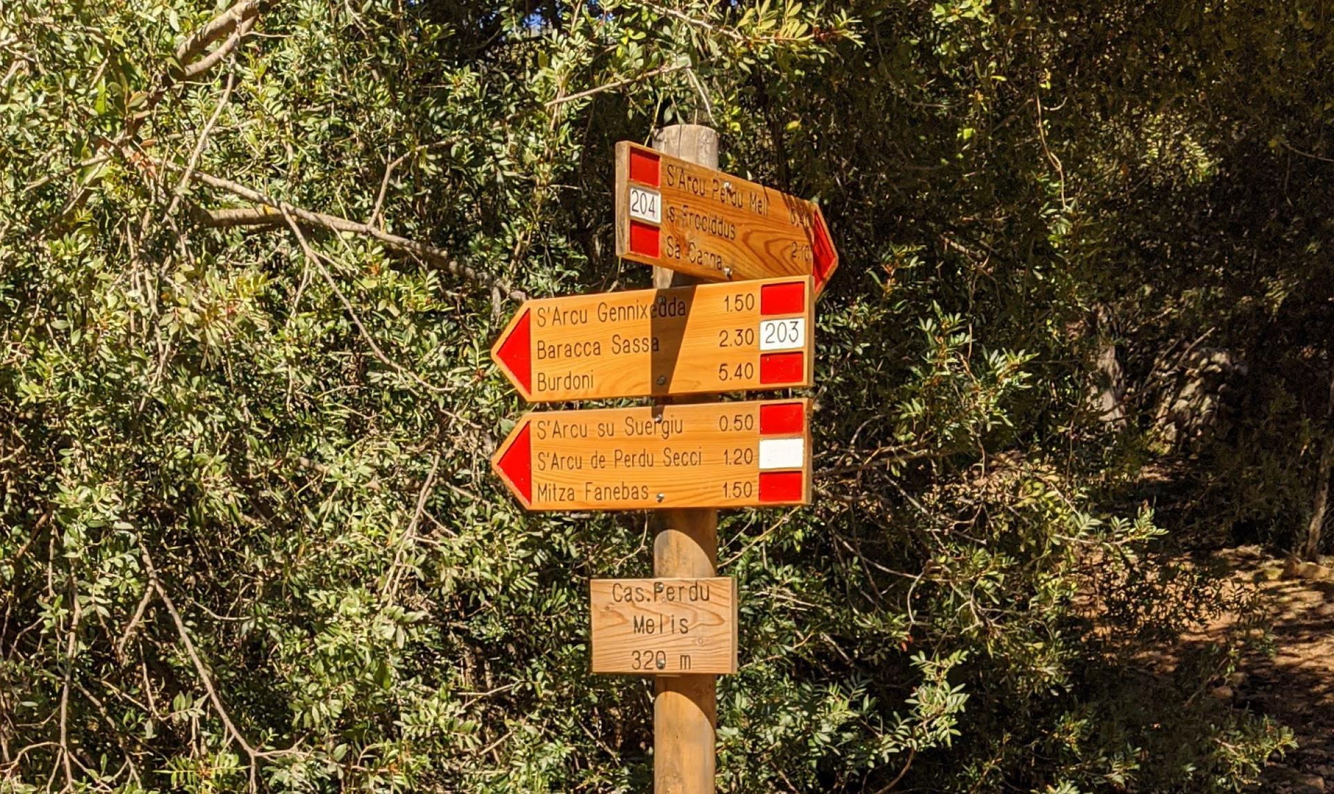
From the former guesthouse P. Melis (304 m asl), at the intersection D 203 and D 204 an arrow indicates the intermediate and final destinations: S'arcu Gennixedda, Barracca Sassa and Burdoni, the respective walking time: 1h 50m, 2h 30 m, 5h 40m.
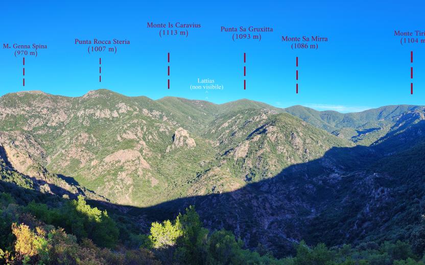
The trail starts with a comfortable cart track that runs along the Guttureddu Canal and then the "Perdu Melis", and leaves on the left the D 220A trail that leads back to the D 220 and the D 217 trails, respectively to Lattias and Sa Canna (stazzu Aroni). After about 50 minutes of walking, the trail turns left and follows a path (in the middle of the vegetation) that in some parts has panoramic views with the ridges of Lattias. It is possible to observe at 360 degrees the valley dominated by the Lattias spires, after having crossed a multitude of small waterfalls on the right. The trail continues to climb until it reaches S'Arcu Gennixedda (739 m s.l.s.).
Proceeding, the trail descends towards the WWF refuge of Barracca Sassa on the Riu Camboni (340 m s.l.s.) and then continues to Punta Tintillu (664 m asl) where it is possible to observe particular granite rocks of various shapes. At this point the trail continues downhill along the Riu de sa Perda: where isnot be unlikely to spot some deers. The trail then turns into an forest trail that after Punta Su Suergiu (529 m s.l.s.) leads into the countryside of Siliqua (to Burdoni). Here there is an equipped and comfortable picnic area.
Overall, following the D 203 trail, Burdoni is more than 20 km away from Sa Canna.


