This short connecting path is a crucial junction, allowing you to leave trail 401 (from Su Carmene di Oliena to Punta Corrasi) and return to Mount Maccione, a rest stop, equipped parking area, and near a lodging facility.
OLIENA: MOUNTAIN SURROUNDED BY OLIVE TREES, WOODS AND SPRINGS
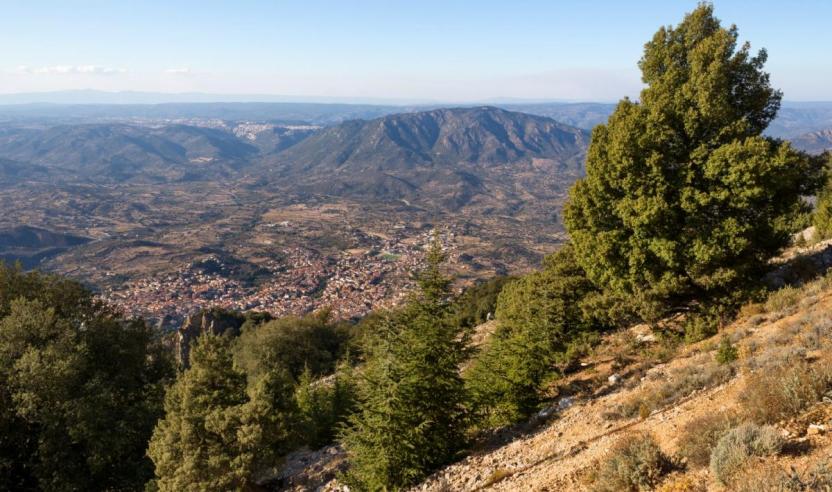
A picturesque town, between the Supramonte and Nuoro areas, rich in limestone reliefs, deep sinkholes, canyons, and lush valleys. The surroundings of Oliena, a village in the Barbagia region at the foot of Mount Corrasi (1463 meters above sea level), ten kilometers from Nuoro, are an immense natural monument, ideal for trekking, hiking, and biking. The first settlement was Roman, a confluence of 'rebellious' peoples such as the Ilienses, according to Sallust, Trojans who took refuge on the Island. Today, the town, populated by about seven thousand inhabitants, boasts the Orange Flag, thanks to the nature, culture, craftsmanship, and hospitality of its community.
HIKING TRAILS NETWORK
A FIRST intervention funded by regional funds (Program Agreement for the Inner Supramonte - Su Suercone) was carried out in 2018 by Forestas in the municipalities of Oliena-Orgosolo-Urzulei-Dorgali, then more recently (2022) Forestas again completed and harmonized the structure of the regional hiking network in the Municipality of Oliena thanks to European funds (ERDF POR). THIS ROUTE iSPART OF THE SENTIERO ITALIA that crosses the entire Supramonte along the main ridges, passing right through Corrasi.