Scala 'e Pradu - Starting Point B-405 Photo credits Photo author Gianluca Schirru Image credits Agenzia Forestas Usefull informations Geographical area Supramontes Route type trekking - waypoint Sentieristica (punti di snodo) The point of interest Scala 'e Pradu represents a junction point for trails B 401, B 405, and B 405A. The Sentiero Italia (Italy Trail) also passes through here with stage Z14. Show more Show less Photogallery 
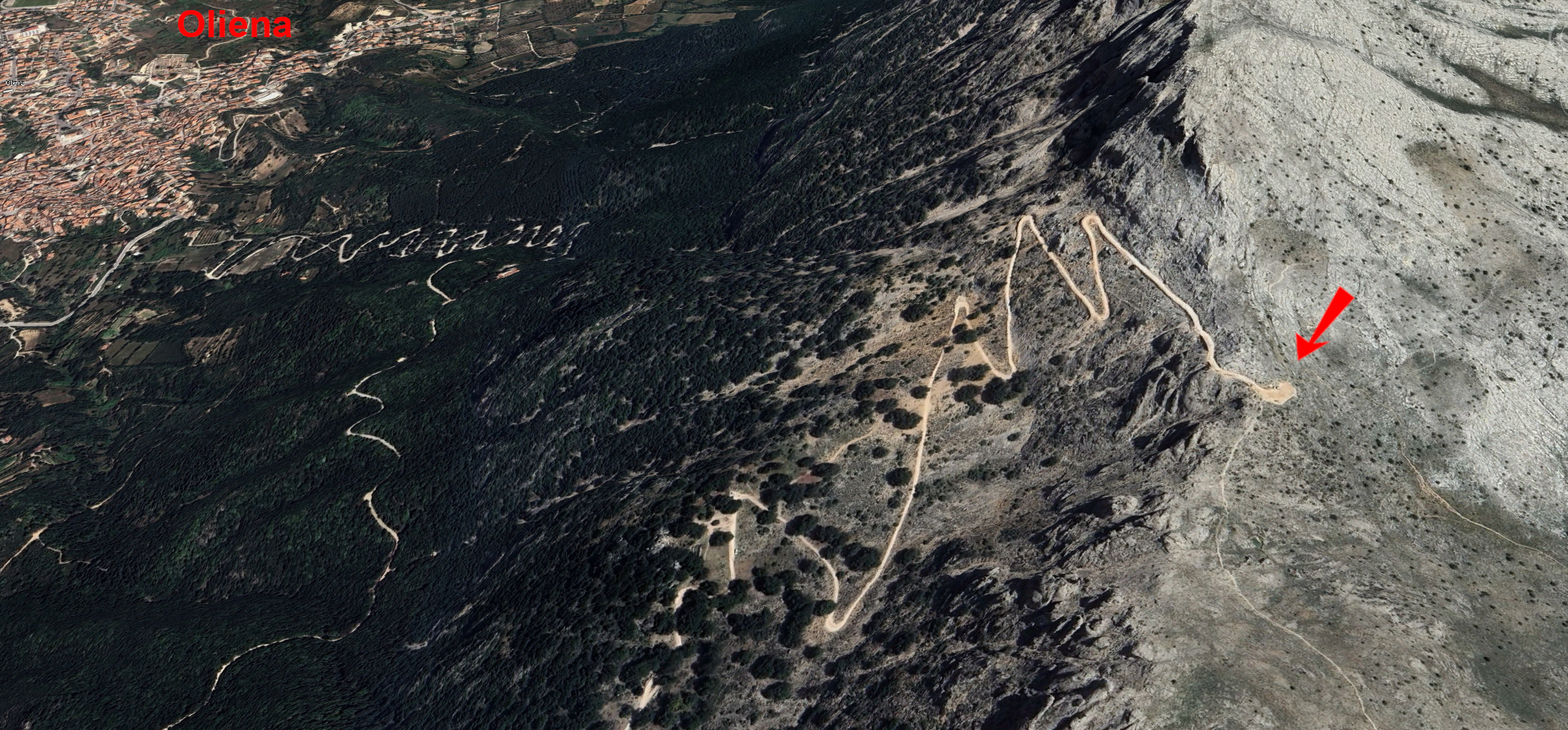
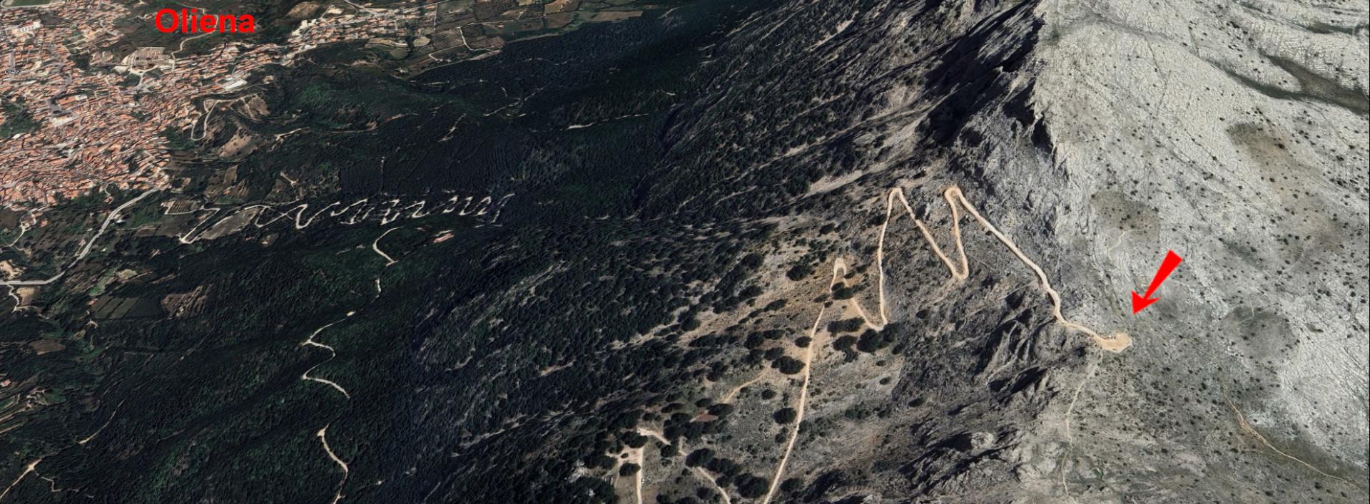
Scala 'e pradu, vista in prospettivaGianluca SchirruAgenzia Forestas 
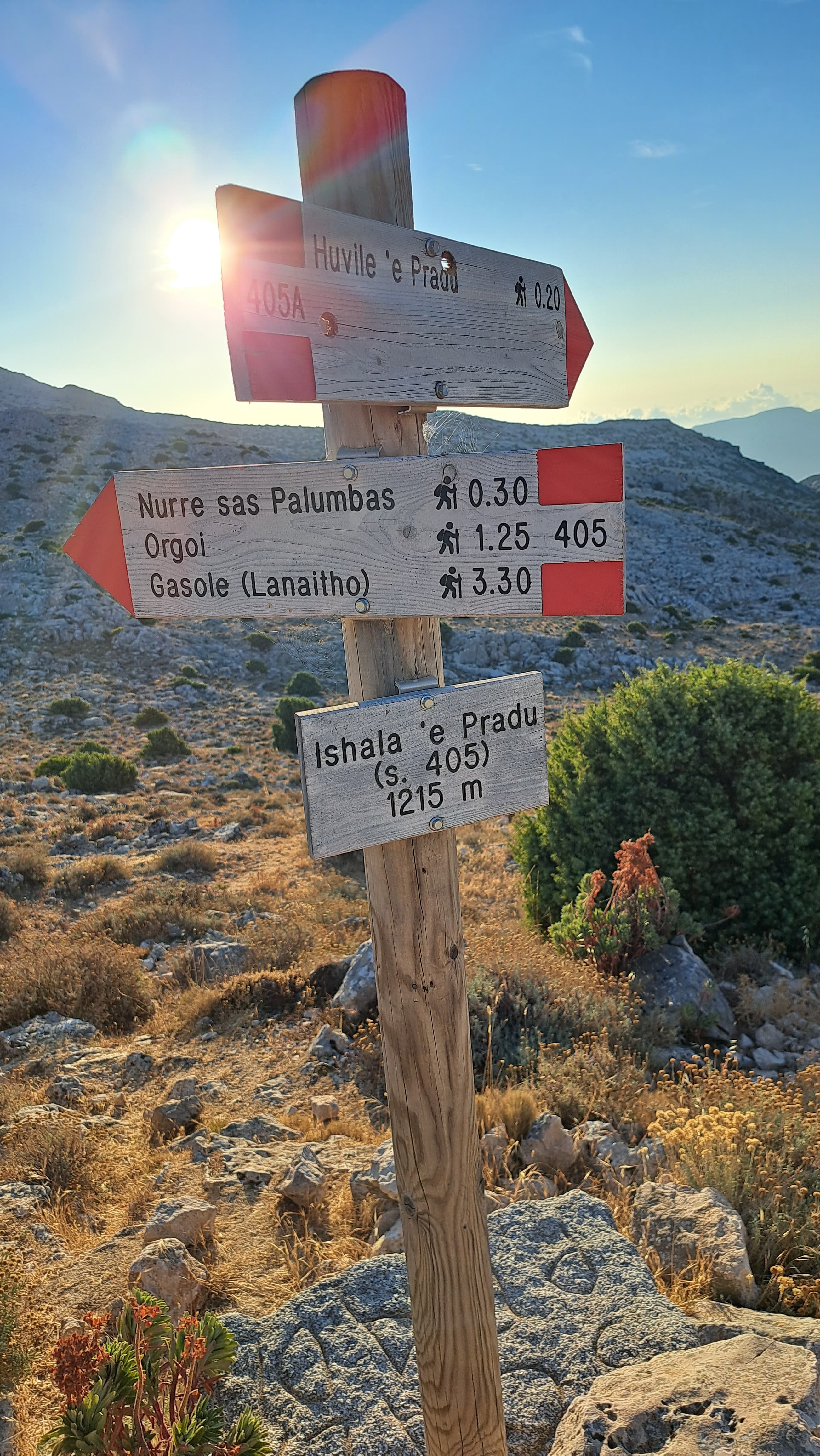
Scala 'e pradu, sentieri B 405 e B 405AGianluca SchirruAgenzia Forestas 
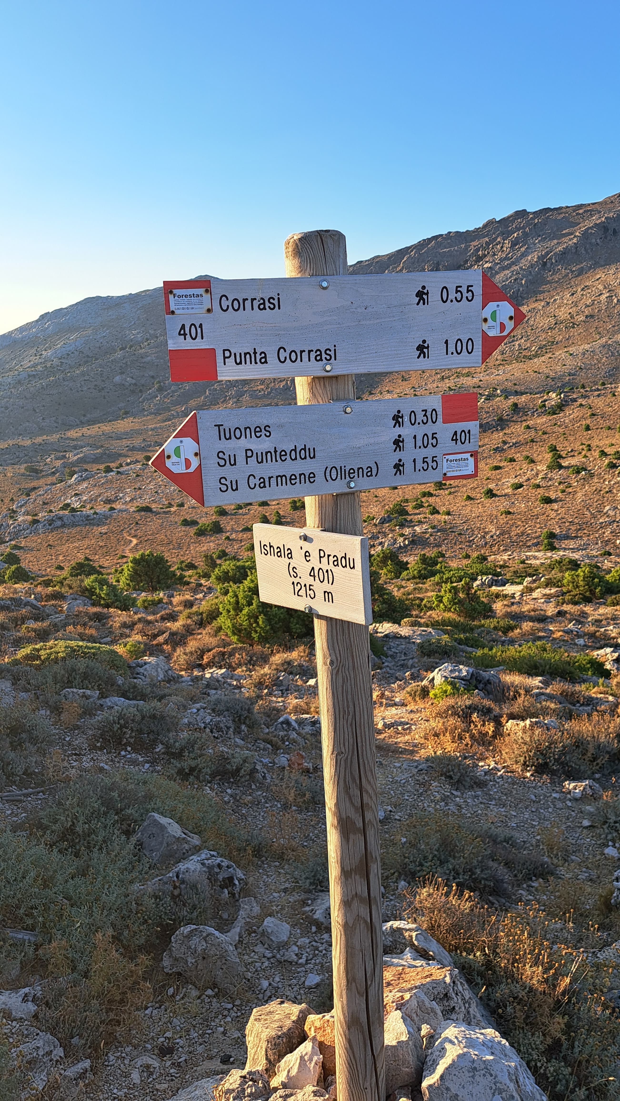
Scala 'e pradu, sentiero B 401Gianluca SchirruAgenzia Forestas POI map Expand map Minimize fullscreen map Skip map and go the next section See on interactive map Related pathways Skip Pathways slider and jump to the next section Pathways Scala 'e Pradu - Gasole (B-405) Time lenght 2 hours Path lenght 8 km 400 m Pathways Oliena - Corrasi Mount (B-401) Time lenght 3 hours 30 minutes Path lenght 6 km 600 m Precedente Successiva Related itineraries Skip the Related itineraries slider and jump to the next section Itineraries Sentiero Italia (Stage Z14) Sa Barva Loc. Surtana - Monte Maccione Difficulty level More infos sui gradi di difficoltà For Experienced Hikers (EE) Editorial informations Updated on 17/04/2025 - 09:45 Created on 29/09/2020 - 10:16
Itineraries Sentiero Italia (Stage Z14) Sa Barva Loc. Surtana - Monte Maccione Difficulty level More infos sui gradi di difficoltà For Experienced Hikers (EE)