From Monteponi to Nebida with a stop at Monte Scorra (D-313)

The pathway
Useful informations
Roadbook
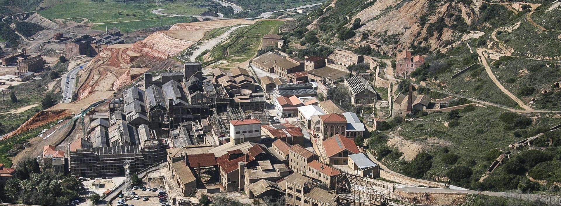
From the small square in front of the entrance to the mining complex, you will see a small church, a kindergarten, a primary school, a hospital, the police station, the post office and a grocery shop. These were the services, most of them now abandoned or taken over by private operators or the city of Iglesias, which the mining companies provided to the workers. After passing under the entrance portal to the mine, head west, going up towards the former mine management building, the ‘Bellavista’ villa, and towards the old brick smokestacks that rise on top of the Monteponi hill.
We are inside a great industry that is largely invisible to our eyes: kilometres of tunnels dug into the rock and that have now regained the darkness, silence and oblivion. The paved road rises decidedly between the buildings, reaches and exceeds the unmistakable shape of the direction up to the altitude of the pozzi Sella and Vittorio Emanuele.
Turning left, you will pass the historical mining archive and leave this landscape of ruins and old abandoned industrial buildings, where lingers the smell of machinery lubricants that brings back the past life of these places.
After passing a gate with no lock, continue westwards on an easy cart track, which will soon give you a view of the huge red mud tailings dumps from ore processing, of reddish colour from the oxidation of ferrous components. This dump is a striking reminder of the complexity of these places. On the one hand, this is industrial waste high in heavy metals that make it dangerous to health and the environment. On the other hand, it is protected on account of its high historical and landscape value. A fascinating landscape that leaves a lasting impression on any visitor.
From this location high above the road, you will see, down in the valley, the abandoned railway station of the Monteponi company and that of the Southern Sardinia Railways (Ferrovie Meridionali Sarde). To the southwest rises the limestone massif of Monte di San Giovanni with its mine of the same name. On its western slope, the buildings of the Normann Village stand out between sky and sea. Continuing the descent on a dirt road in very good conditions, you will reach the abandoned ‘Galletti’ ore processing plant. Built in 1961, almost entirely in concrete, it was used for the flotation of calamine ore from the Monteponi mine.
Past the ore processing plant, continue downhill until the crossing with Provincial road SP 84, which, to the north, skirts the town of Iglesias between Bindua and the district of Sant’Antonio. You will find yourselves at the entrance to the miners’ village of Monte Agruxiau which takes its name from the hill above it and the mine of the same name, which once belonged to the Belgian company ‘Vieille Montagne’.
After a brief visit to the small miners’ village, which is still inhabited, take a beautiful panoramic forest track, which is closed to vehicles and presents no technical difficulties. The route is well signposted and easy to walk on as it is surfaced with ecological conglomerate. Please remember to bring enough water with you, as from the Monteponi mine to the end point there are no springs or water fountains for refilling your water bottles.
Continuing along the dirt road, you will soon reach another old miners’ village, Monte Scorra [intermediate stop point]. Founded in the late 19th century by the Società Anonima delle Miniere della Malfidano’ and abandoned for decades, it is now in ruins and almost totally overgrown by vegetation that, once man’s activity ceased, has reclaimed the places it originally occupied. From here, you will start to feel the scent of the sea, now only a few kilometres away.
Once you reach the Genn’e Murtas pass, you will see the ruins of the Pitz’e Luas mine. Continuing on the narrow inter-municipal road, you will get to the tarmac road leading to the village of Nebida.
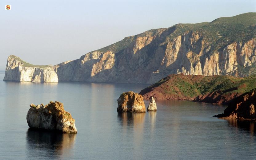
From the pass overlooking the sea, the view covers the panorama between Portoscuso and the beautiful seastack of Pan di Zucchero meaning ‘Sugarloaf’, for its white colour, while its traditional Sardinian name was Concali su terrainu or half donkey head. This majestic rock is a stunning natural monument of Sardinia. The area, despite the wounds inflicted by mining activities, has landscapes of extraordinary beauty. Your walk ends, after a short stretch among the houses, in the town’s central square.
Trail data and altimetry
Download trail documentation
Opinions
No reviews yet for this path


