Image credits GAL BMG
The point of interest
How to get here
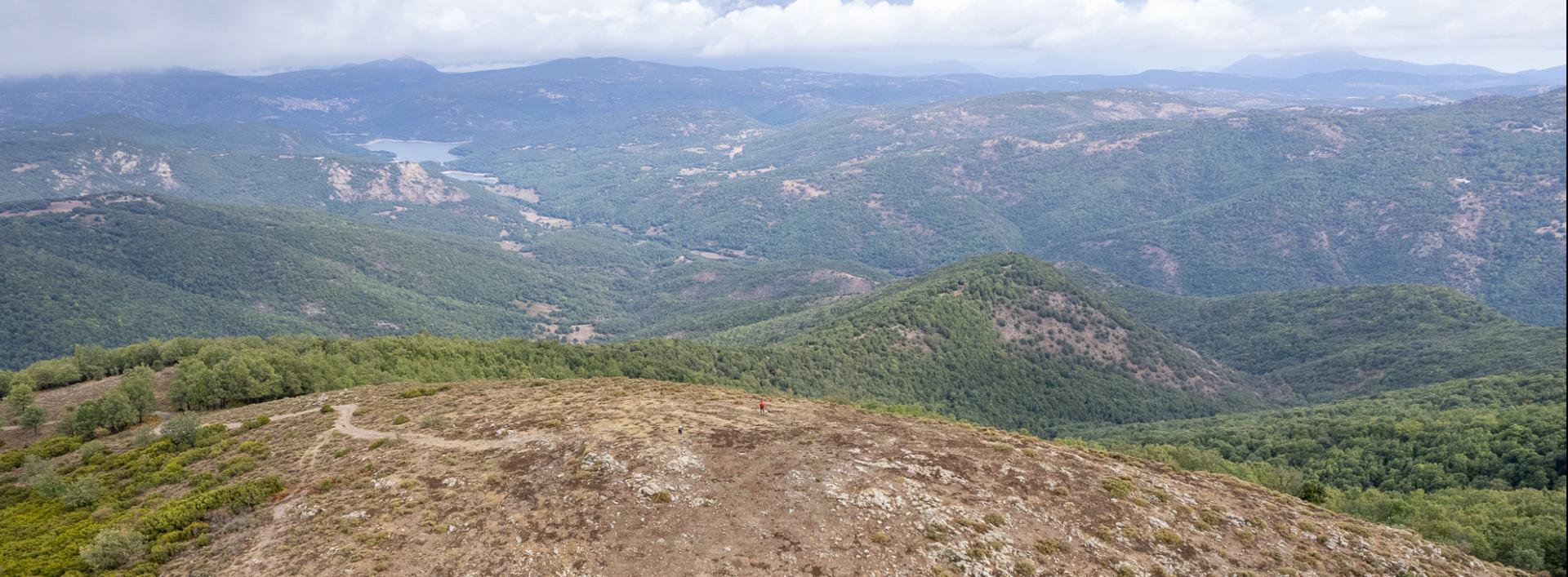
After passing the Godditorzu locality, proceed straight ahead, passing an isolated electricity pole. The dirt road soon becomes a cart track and begins to climb steeply in a magnificent forest, mainly of young holm oaks and pubescent oaks, interspersed with heather and sporadic holly. Take a right at the next junction, always keeping to what appears to be the main dirt road and passing various forks in the road. Make sure you keep going uphill: as you gain elevation, you will see small openings in the vegetation that unveil glimpses of the Barbagia di Ollolai. From the barren summit of Mihinari, the panorama is superb and extends over the entire horizon, taking in the Gennargentu range, the Taloro and Aratu valleys, the distant Supramonte massif and the faraway western uplands. At the foot of the mountain, the Rio Torrei ravine with its small artificial lake.