Route summary
Difficulty level More infos sui gradi di difficoltà Intermediate-high difficulty (E-level) soft mobility (medium level)
Lenght 17.000 m
Time lenght 6 hours 15 minutes
The itinerary
About the territory
The territory of the Baronie runs from the limestone chain of Montalbo to the massif of Tuttavista, an area marked by streams and rivers such as the Isalle and the Cedrino and wide alluvial plains.
Map No. 1 (Baronie) suggests an itinerary in the Baronie territory, based on three trails.
In this aera, the Montalbo range is especially important for its natural heritage. Thanks to its environmental characteristics and good conservation status, it is home to a number of rare and endemic animal and plant species, including the Santolina corsica, the Lactuca longidentata, the Monte Albo cave salamander, the red-billed chough, the golden eagle and the mouflon.
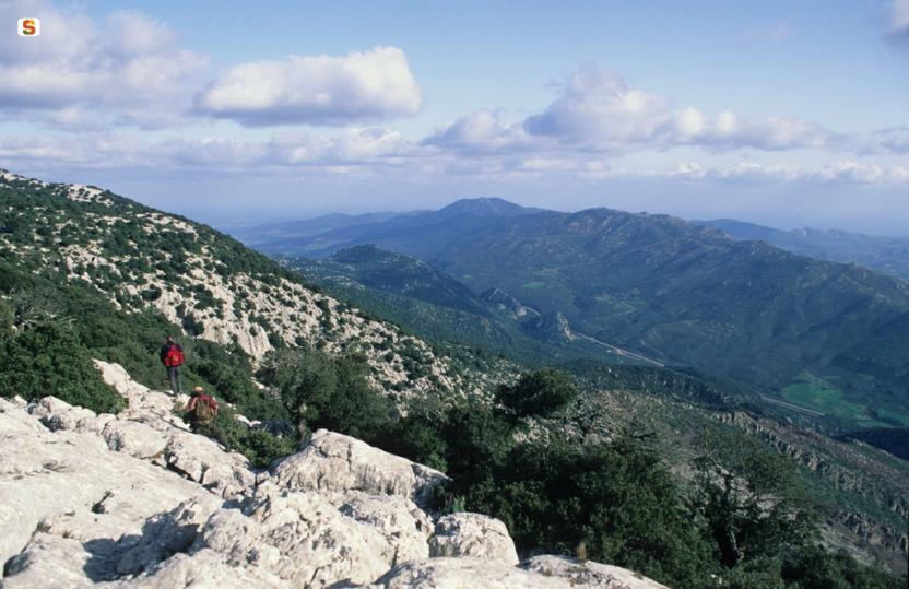
Along the walking routes proposed in this itinerary, you can also find ancient charcoal pits and make a stop at the old sheepfolds (pinnettos). You will also enjoy the stunning views offered by the numerous stretches at altitudes above 900m a.s.l. on the ridges of the Montalbo massif.
The Pinnetos
The Pinnettos are original stone and wood huts which for many centuries were the solitary shelters of the Sardinian shepherds, around which they raised their goats, sheep and pigs. These huts are a testimonial to the old life of the shepherds, governed by the rhythms of nature and the seasons. The main building, called Su Pinnettu or Su Barracu, according to the area, consists of a dry-stone circular wall surmounted by a cone-shaped roof made of holm oak and juniper planks and branches, lined with smaller branches and leaves. Inside, it has a central fireplace, probably very similar to the fireplaces of the ancient nNuragic huts, called Su Foghile, while a series of shelves along the wall served to store the shepherds’ tools and the products of their work, such as wheels of cheese and hams. Su Pinnettu is often flanked by a smaller hut used as a toolshed, surrounded by a dry stone pen for holding the sheep, called Sa corte; the pen also included smaller enclosures, called Cherinas, used to hold baby goats. The pigsty, on the other hand, consisted of a low rectangular hut with an enclosure.
Montalbo
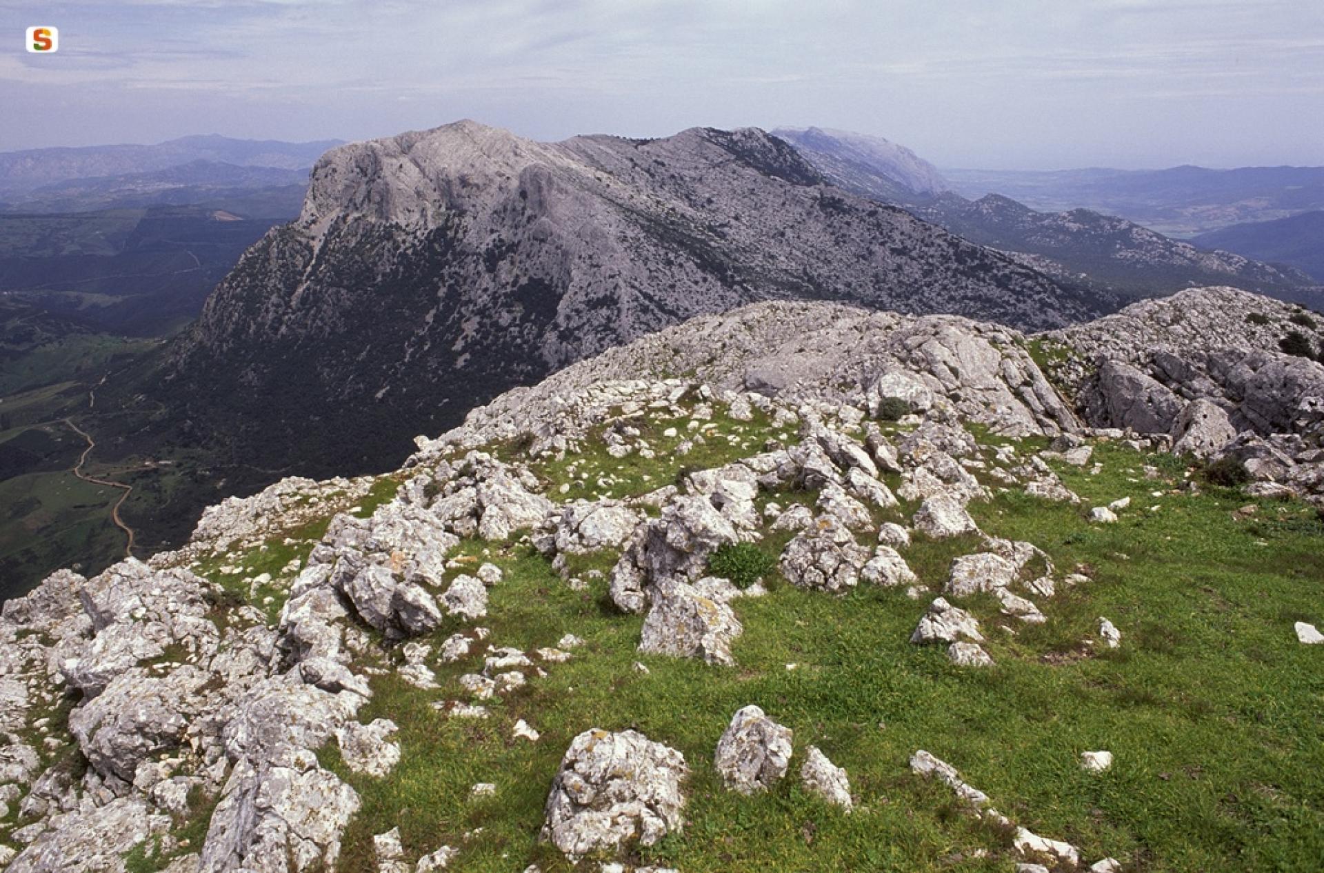
A limestone bastion about 20 km long, Monte Albo with its distinctive long and imposing profile, overlooks the historical territory of the Baronie. This limestone massif dates back to the Mesozoic and is rich in white stone ravines and caves. Characterised by steep slopes, cut by deep ravines, it reaches its maximum height with the peaks of Punta Catirina and Punta Turuddò, which exceed 1050 m. a.s.l. The entire area preserves and maintains significant examples of the Mediterranean maquis and local endemic flora. The area is inhabited by many animal species such as the Montalbo cave salamander, the mouflon, the red-billed chough, the common raven, the wildcat and the marten. At certain times of the year, the golden eagle nests there. An impressive sight is the sinkhole of Tumba ’e Nurrai, located between Punta Catirina and Punta Turuddò. In the imposing summit of Punta Catirina opens the cave of Janna Manna, about 200 m long, which lies at a short distance from that of Omines Agrestes. On the Monte Albo, human presence has been documented since the Neolithic period, with the domus de janas of Mannu ‘e Gruris, rock-cut chamber tombs with a carved door frame and four cells. Throughout the massif there are many caves that were used in prehistoric times as natural shelters. One of these is the cave of Bona Fraule, in the municipality of Siniscola, where valuable objects such as swords and iron daggers have been found, suggesting that it was used as a place of worship. Monte Albo falls mainly within the municipalities of Siniscola and Lula, which can be reached via State Road 131 D.C.N. and following the road signs from there.
Itinerary data
Validation level In revisione-validazione
Lenght 17.000 m
Difficulty level More infos sui gradi di difficoltà Intermediate-high difficulty (E-level) soft mobility (medium level)
Time lenght 6 hours 15 minutes
Total elevation gain 1 325 metri
Photogallery
Attachments
Videos
Related pathways
Skip Pathways slider and jump to the next sectionPathways Corru 'e mandra - Badde Viola - Sa 'e Tamponi
-
Time lenght 4 hours 15 minutes
-
Path lenght 11 km 400 m
Related Points of interest
Skip POI slider and jump to the next sectionPoints of interest Monte Albo
-
Route location Monte Albo
Points of interest Talisi Fountain
-
Route location Funtana 'e Talisi
Points of interest Passo di Corru 'e mandra
-
Route location Monte Albo

Points of interest Crocevia Lula-Lodè-Siniscola (S.P. 3)
-
Route location Monte Albo (versante Lula)
Points of interest Cantiere Forestale di Sa Mela
-
Route location Sa mela (Lodè)
Points of interest Secular Maple
-
Route location Funtana Mariane 'e Jana
Points of interest Punta Ferulargiu (1050 m.s.l.m.)
-
Route location Monte Albo
Points of interest Cuile Orthoruta
-
Route location Cuile Orthoruta

Points of interest Nuraghe Lithu Ertiches
-
Route location Nuraghe Lithu Ertiches, Monte Arbu (Siniscola e Lodè)


